01
Chefchaouen, Morocco
Trek through the Rif Mountains from Chefchaouen
The Rif Mountains are in northern Morocco — very different from the Atlas.
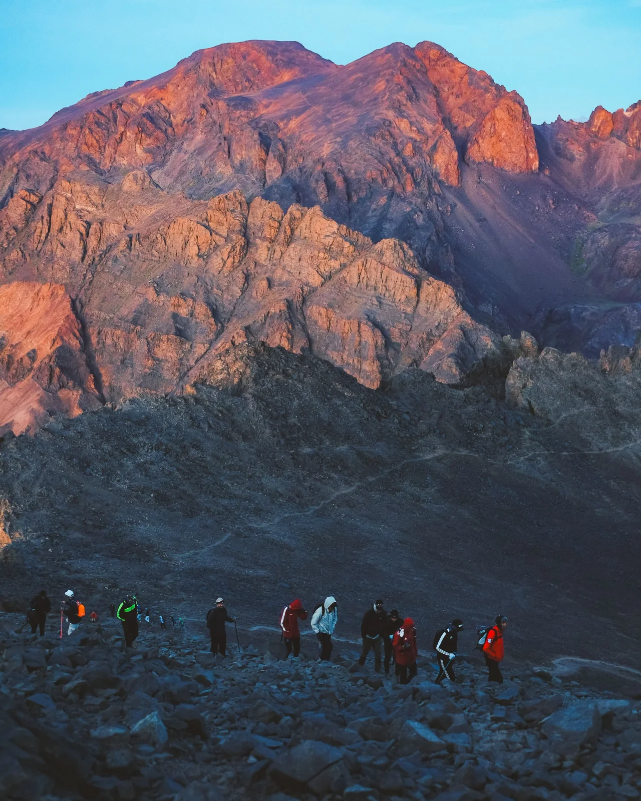
A three-day trek in the Rif Mountains above Chefchaouen — pine forests, limestone peaks, and the blue city below.
Duration
3 Days
Difficulty
Moderate
Elevation
Up to 1,800 m
Best Season
Mar–Nov
Start
Chefchaouen
Private
Yes
Start
Chefchaouen
End
Chefchaouen
Distance
Approx. 40 km trekking
Format
Private & customizable
Difficulty profile
A practical seven-step scale built from the route data on this page. It is intended to help you compare journeys, not to replace medical advice or a guide's on-the-ground assessment.
3/7
Moderate
Moderate
3 Days
Up to 1,800 m
Chefchaouen
Approx. 40 km trekking
Mar–Nov
Why this rating makes sense
With a difficulty rating of 3, this trek requires a reasonable level of fitness and prior hiking experience. Days involve several hours of walking with elevation gain and loss on trails that can be rough in places. It is not suitable for those with knee or joint problems, as descents can be hard on the body. Accommodation in homestays means basic facilities and shared spaces. It suits experienced hikers who are comfortable with rustic conditions and multi-day walking.
The radar is a planning aid derived from the route information already published on this page; it is not a medical or technical grading.
Why This Journey?
This is for trekkers who want the Rif Mountains — a different range from the Atlas, with the blue-washed city of Chefchaouen as the base. A cultural trek through pine forests and hilltop villages.
Journey overview
The Rif Mountains rise above Chefchaouen to over 2,000 m, with pine forests, limestone ridges, and trails used by local herders. This trek explores the higher Rif around Chefchaouen — walking through forests, past springs, and to viewpoints overlooking the blue city and the surrounding mountains. It is a different mountain experience from the Atlas — lower, greener, and less visited.
It is planned as a 3 days experience with the route beginning in Chefchaouen and finishing in Chefchaouen The listed difficulty is moderate with a stated high point or elevation of Up to 1,800 m and an approximate distance of Approx. 40 km trekking. The current itinerary data lists Mar–Nov as the best season.
The journey is structured around Day 1: Chefchaouen to mountain camp (Chefchaouen → Rif Mountains); Day 2: Rif Mountains trekking (Rif Mountains); Day 3: Return to Chefchaouen (Rif Mountains → Chefchaouen). Key elements include Trek through the Rif Mountains from Chefchaouen; Visit the blue city of Chefchaouen; Walk through pine forests and mountain trails; Views across the Rif range.
This is for trekkers who want the Rif Mountains — a different range from the Atlas, with the blue-washed city of Chefchaouen as the base. A cultural trek through pine forests and hilltop villages. Expect multi-day trekking through forested ridges, valleys, and traditional villages, with the blue-washed town of Chefchaouen often serving as a base or endpoint. Trails pass through pine and oak forests, along ridge lines with Mediterranean views, and through rural hamlets where you encounter local farming communities. Accommodation is typically in village guesthouses or homestays rather than tents. Food is simple Moroccan home cooking prepared by hosts. The trekking days involve several hours of walking on trails that are generally less steep than High Atlas routes. With a difficulty rating of 3, this trek requires a reasonable level of fitness and prior hiking experience. Days involve several hours of walking with elevation gain and loss on trails that can be rough in places. It is not suitable for those with knee or joint problems, as descents can be hard on the body. Accommodation in homestays means basic facilities and shared spaces. It suits experienced hikers who are comfortable with rustic conditions and multi-day walking.
For the guest
For guests choosing a Morocco trekking holiday, the value is in the rhythm of walking, the changing landscape and the chance to spend time in places that are easy to pass by on a road trip.
If you are researching rif mountains, this page is designed to answer the questions that matter before booking: what the days feel like, who the route suits, what the route includes and what conditions to prepare for.
The practical side matters too: this is a moderate journey over 3 Days, with the best travel window listed as Mar–Nov. With a difficulty rating of 3, this trek requires a reasonable level of fitness and prior hiking experience. Days involve several hours of walking with elevation gain and loss on trails that can be rough in places. It is not suitable for those with knee or joint problems, as descents can be hard on the body. Accommodation in homestays means basic facilities and shared spaces. It suits experienced hikers who are comfortable with rustic conditions and multi-day walking.
About the Region
The Rif Mountains form a chain across northern Morocco, running roughly east to west parallel to the Mediterranean coast. The range is lower and more rounded than the Atlas, with peaks reaching around 2,400 metres at Jbel Tidirhine. The landscape is notably greener than the rest of Morocco, with Mediterranean scrub, cork oak forests, and terraced agriculture in the valleys. The region receives more rainfall than the Atlas, supporting a more lush and humid environment. The area is densely populated by Berber and Arabic-speaking communities, with towns like Chefchaouen nestled in the mountains.
Continue planning Morocco
Compare this Rif Mountains trek from Chefchaouen with the places and practical guides that help travelers understand the route before booking.
Destinations on this route
Morocco travel guides
Journey highlights
A route-specific field guide built from the places, highlights and activities already recorded for this journey.
Chefchaouen, Morocco
The Rif Mountains are in northern Morocco — very different from the Atlas.

Chefchaouen, Morocco
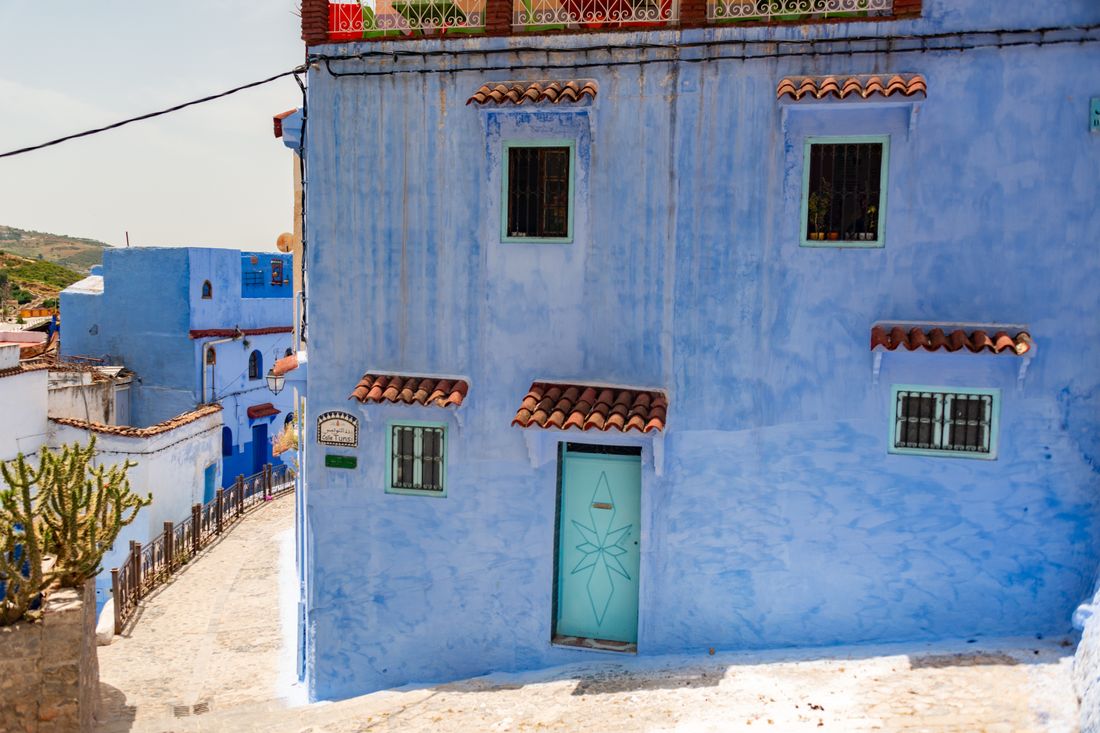
Chefchaouen is the blue city — one of Morocco's most photographed towns.
Journey stage
The Rif is lower than the Atlas — altitude is moderate.
Journey stage
Best from March to November.
Journey stage
This is for trekkers who want the Rif Mountains — a different range from the Atlas, with the blue-washed city of Chefchaouen as the base. A cultural trek through pine forests and hilltop villages.
Journey stage 1
Chefchaouen to mountain camp
Journey stage 1
Chefchaouen to mountain camp
Journey stage 1
Chefchaouen to mountain camp
Journey stage 1
Chefchaouen to mountain camp
Journey stage 2
Rif Mountains trekking
Journey stage 2
Rif Mountains trekking
Journey stage 2
Rif Mountains trekking
Good to know
Trekkers who want to explore the Rif Mountains
Good to know
Those visiting Chefchaouen who want more than the city
What to experience
A visual route guide built around the actual places and experiences named in this itinerary. Each photograph is chosen from the matching location pool, while the note beside it explains why that moment matters to a guest.
Chefchaouen, Morocco
Expect a more sensory part of the journey here: architecture, movement, craft, food and the small details that are easy to miss when a city is rushed. Trek through the Rif Mountains from Chefchaouen is presented as part of the route so guests can understand why this stop matters, not just where the photograph was taken.
Chefchaouen, Morocco
Expect a more sensory part of the journey here: architecture, movement, craft, food and the small details that are easy to miss when a city is rushed. Visit the blue city of Chefchaouen is presented as part of the route so guests can understand why this stop matters, not just where the photograph was taken.
Gallery
16 photos
Route & Map
Key locations on this journey. Markers show the verified waypoints available for this route; the map does not claim exact trail geometry.
Day-by-Day
This is a suggested itinerary. Every journey is adjustable — pace, activities, and accommodation.
Walking
5–6 hours
Elevation
600 m → 1,500 m
Meals
Lunch, dinner
Accommodation
Tented camp
Walking
5–6 hours
Elevation
1,500 m → 1,800 m → 1,500 m
Meals
Breakfast, lunch, dinner
Accommodation
Tented camp
Walking
4–5 hours
Elevation
1,500 m → 600 m
Meals
Breakfast, lunch
Accommodation
Not included
What You Will Experience
Expect multi-day trekking through forested ridges, valleys, and traditional villages, with the blue-washed town of Chefchaouen often serving as a base or endpoint. Trails pass through pine and oak forests, along ridge lines with Mediterranean views, and through rural hamlets where you encounter local farming communities. Accommodation is typically in village guesthouses or homestays rather than tents. Food is simple Moroccan home cooking prepared by hosts. The trekking days involve several hours of walking on trails that are generally less steep than High Atlas routes.
Journey character
Physical Demands
5–6 hours of walking per day on mountain trails
Moderate altitude (up to 1,800 m)
Uneven terrain
Tented camping
Best Time to Go
The March to November window covers the usable trekking season, with spring and autumn being the most comfortable periods. Summer is feasible at higher elevations where temperatures remain moderate, though lower valleys can be hot. Winter brings rain and occasional snow to the higher ridges, making trails muddy and less reliable. Spring offers the greenest landscapes and wildflowers, while autumn provides clearer skies and cooler hiking conditions.
Is This Right for You?
Trekkers who want to explore the Rif Mountains
Those visiting Chefchaouen who want more than the city
People who enjoy pine forests and mountain trails
Anyone who wants a northern Morocco trek
Those who want high altitude (the Rif is lower than the Atlas)
Travelers who prefer comfortable accommodation
Those seeking desert landscapes
What's Included
Qualified local guide
Tented camp accommodation
All meals during the trek
Cooking equipment
Local mountain guide
Round-trip transport from Chefchaouen
Accommodation in village guesthouse
Accommodation in Chefchaouen
Personal trekking gear
Personal non-alcoholic beverages
Tips
Transport to Chefchaouen
Practical Information
Tented camps — basic but adequate. Bring a sleeping bag.
Walking from Chefchaouen. Transport to Chefchaouen can be arranged.
Simple mountain cooking — tagine, couscous, soup, bread, tea.
What to Pack
Sturdy hiking boots
Warm layers for evenings
Sleeping bag
Rain jacket
Sun protection
Headlamp
Water bottles
First aid kit
FAQs
No — the Rif is lower (up to 1,800 m vs 4,000+ m in the Atlas) and the terrain is gentler. It is a moderate trek.
The Rif is a coastal mountain range with Mediterranean vegetation, limestone peaks, and trails connecting Amazigh villages around Chefchaouen.
Yes — March to May is ideal for wildflowers, with mild temperatures and green hillsides.
This is a starting point. We will tailor every detail to your dates, interests, and travel companions.
From
Chefchaouen
Related Journeys