Toubkal Summit Trek — High Atlas, Morocco
TrekkingHigh Atlas Private

Toubkal Summit Trek

A two-day trek to the highest peak in North Africa — summit Mount Toubkal at 4,167 m with an overnight at the Neltner Refuge, starting and ending in Marrakech.

Duration

2 Days

Difficulty

Challenging

Elevation

4,167 m

Best Season

Apr–Oct

Start

Imlil (1,740 m)

Private

Yes

Start

Imlil (1,740 m)

End

Imlil

Distance

Approx. 20–30 km, route-dependent

Format

Private & customizable

How demanding is this journey?

A practical seven-step scale built from the route data on this page. It is intended to help you compare journeys, not to replace medical advice or a guide's on-the-ground assessment.

EffortTerrainExposureAltitudeEndurance

5/7

Challenging

Difficulty

Challenging

Duration

2 Days

Elevation

4,167 m

Start

Imlil (1,740 m)

Distance

Approx. 20–30 km, route-dependent

Best Season

Apr–Oct

Why this rating makes sense

This is a difficulty-5 trek suitable for fit, experienced hikers comfortable with sustained ascending over two consecutive days at altitude. The summit day involves roughly 1,000 meters of gain on loose scree and boulders followed by a long descent of over 2,400 meters, which is hard on knees and requires solid conditioning. No technical climbing is needed in summer, but altitude sickness is a real risk above 3,500 meters and anyone with knee, heart, or respiratory issues should consult a doctor beforehand. It is not appropriate for casual walkers or anyone unprepared for cold, exposed conditions near the summit.
The radar is a planning aid derived from the route information already published on this page; it is not a medical or technical grading.

This is for travelers who want a genuine mountain experience — not a curated walk. The trek to Toubkal demands fitness and patience, but the reward is standing on the highest point in North Africa, looking across a range that has shaped life in Morocco for centuries.

Toubkal Summit Trek: what the journey is really like

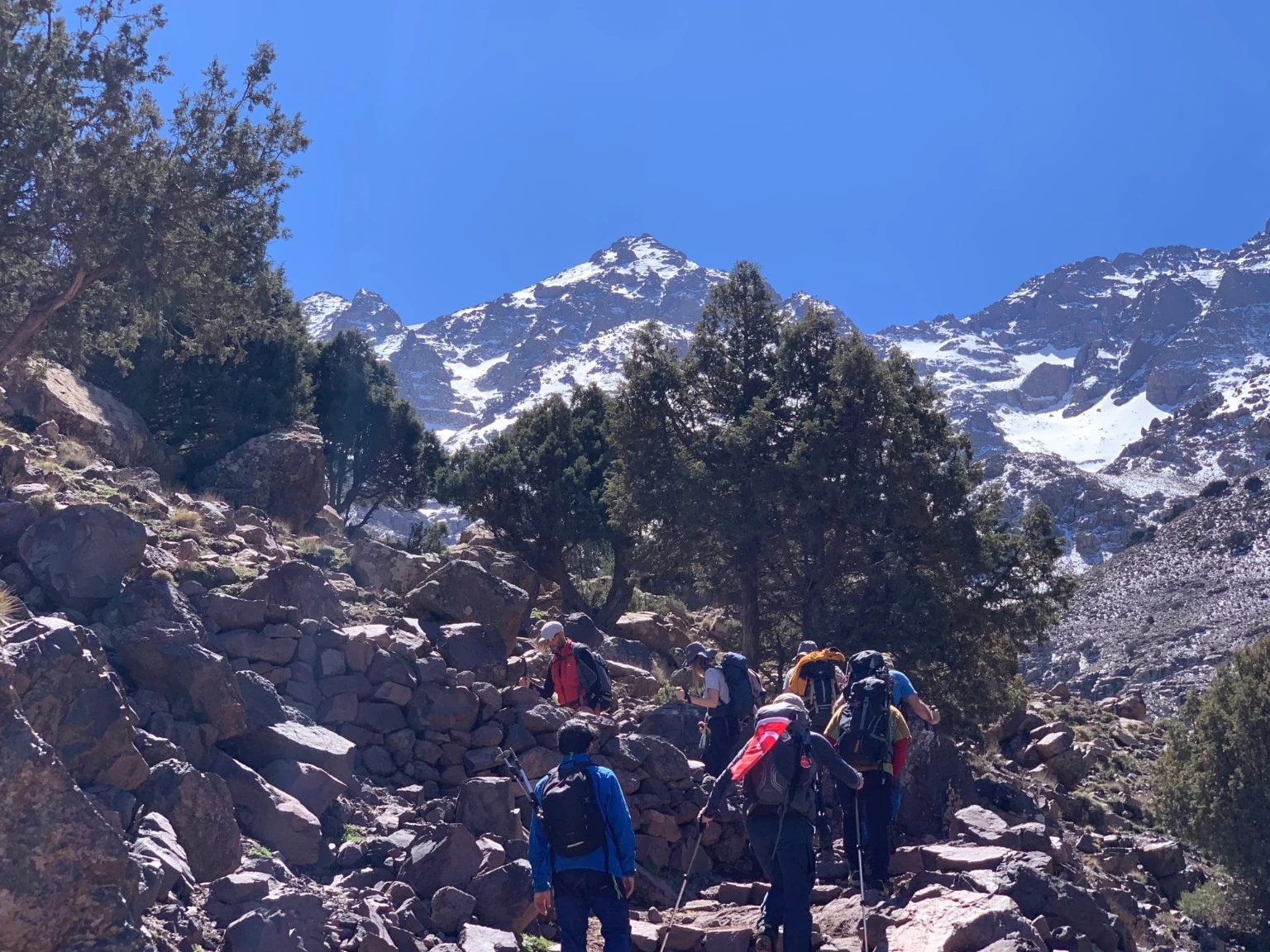
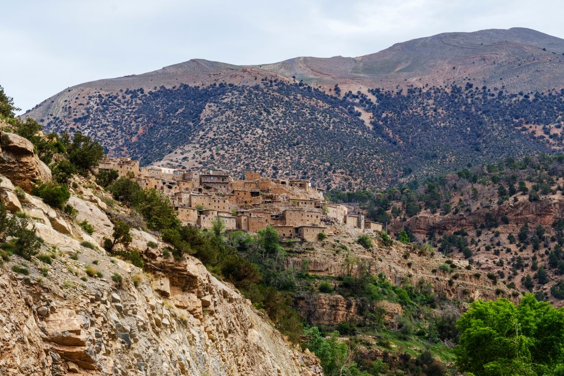
From the trailhead at Imlil, the path climbs steadily through walnut groves and terraced fields, passing Amazigh villages where life follows the rhythm of the seasons. Above the tree line, the landscape opens into a high valley of scree and sparse grass, and the final ascent to Toubkal's summit ridge reveals the entire Atlas range stretching south toward the Sahara. This is a real mountain trek — not a guided walk — and the altitude, terrain, and weather demand respect.

It is planned as a 2 days experience with the route beginning in Imlil (1,740 m) and finishing in Imlil The listed difficulty is challenging with a stated high point or elevation of 4,167 m and an approximate distance of Approx. 45 km. The current itinerary data lists Apr–Oct as the best season.

Key elements include Summit of Mount Toubkal — the highest point in North Africa at 4,167 m; Trek from Imlil through Amazigh villages to the Neltner Refuge; High valley landscapes above the tree line; Panoramic views from the summit ridge across the Atlas to the Sahara.

This is for travelers who want a genuine mountain experience — not a curated walk. The trek to Toubkal demands fitness and patience, but the reward is standing on the highest point in North Africa, looking across a range that has shaped life in Morocco for centuries. You will trek from Imlil upward through terraced villages and walnut groves to a mountain refuge at about 3,200 meters, where you spend the first night. The pre-dawn summit push on day two follows a steep scree and boulder path to the 4,167-meter cairn-marked top, weather permitting, then descends all the way back to Imlil. Accommodation is in a shared mountain refuge with basic dormitory bunks and communal meals. You will need a qualified guide, and mule porters typically carry group gear and food. Expect significant altitude gain on foot, cold conditions near the summit, and panoramic views across the High Atlas and toward the Anti-Atlas on clear days. This is a difficulty-5 trek suitable for fit, experienced hikers comfortable with sustained ascending over two consecutive days at altitude. The summit day involves roughly 1,000 meters of gain on loose scree and boulders followed by a long descent of over 2,400 meters, which is hard on knees and requires solid conditioning. No technical climbing is needed in summer, but altitude sickness is a real risk above 3,500 meters and anyone with knee, heart, or respiratory issues should consult a doctor beforehand. It is not appropriate for casual walkers or anyone unprepared for cold, exposed conditions near the summit.
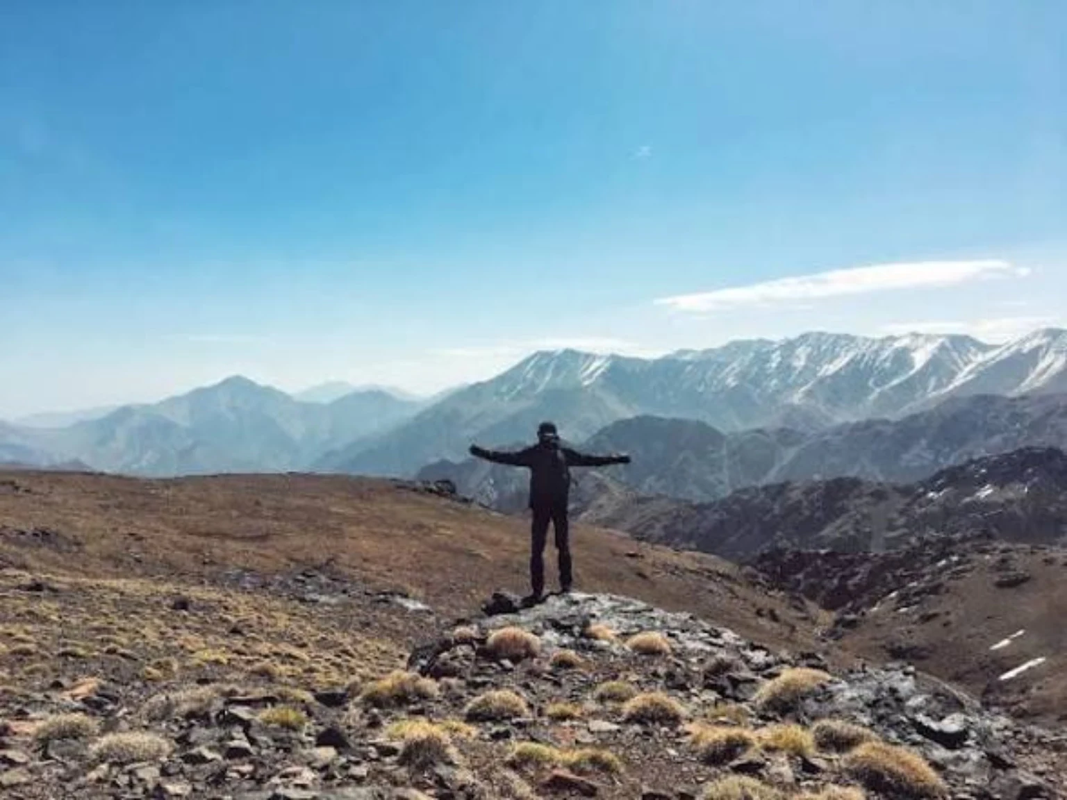
For guests choosing a Morocco trekking holiday, the value is in the rhythm of walking, the changing landscape and the chance to spend time in places that are easy to pass by on a road trip.

If you are researching toubkal trek, this page is designed to answer the questions that matter before booking: what the days feel like, who the route suits, what the route includes and what conditions to prepare for.

The practical side matters too: this is a challenging journey over 2 Days, with the best travel window listed as Apr–Oct. This is a difficulty-5 trek suitable for fit, experienced hikers comfortable with sustained ascending over two consecutive days at altitude. The summit day involves roughly 1,000 meters of gain on loose scree and boulders followed by a long descent of over 2,400 meters, which is hard on knees and requires solid conditioning. No technical climbing is needed in summer, but altitude sickness is a real risk above 3,500 meters and anyone with knee, heart, or respiratory issues should consult a doctor beforehand. It is not appropriate for casual walkers or anyone unprepared for cold, exposed conditions near the summit.

Where this Toubkal trek takes place

The Toubkal massif sits in the central High Atlas, roughly 60 kilometers south of Marrakech, and culminates at Jbel Toubkal, 4,167 meters, the highest point in North Africa. The landscape is steep and rocky, with deep river valleys, scree slopes, and glacially shaped ridges supporting small Amazigh villages and agricultural terraces. Vegetation thins rapidly above 2,500 meters, giving way to juniper scrub and then bare stone. The mountain is accessed from the road-end village of Imlil at roughly 1,740 meters. Conditions are dry and sunny for much of the year, but storms can occur in summer and snow and ice cover the upper mountain from roughly November through April.

Compare this Toubkal trek with the places and practical guides that help travelers understand the route before booking.

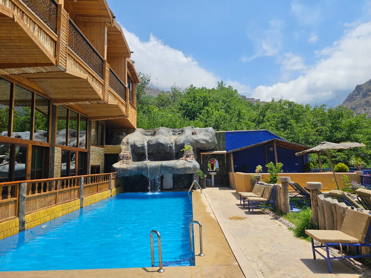
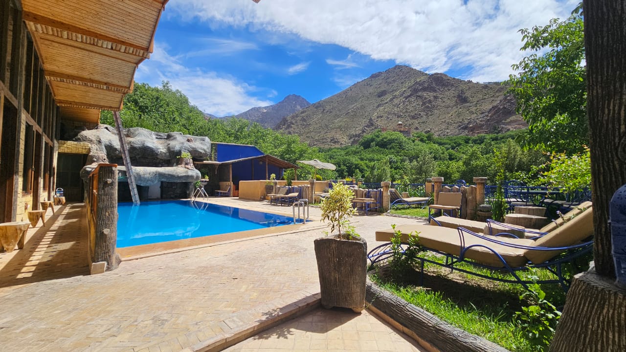
Riad Jnane Imlil swimming pool with High Atlas mountain views in Imlil, MoroccoMountain-view pool at Riad Jnane Imlil in the High Atlas

Stay in Imlil

A natural base for your Toubkal journey

Riad Jnane Imlil

For guests who want to stay in Imlil before or after a mountain experience, Riad Jnane Imlil offers a family-run base in the valley, with mountain views, a garden and pool, Moroccan breakfast, and access to local mountain experiences. It is especially well placed for travelers using Imlil as the starting point for Toubkal and High Atlas trekking.

Rooms & suites

Toubkal & Atlas treks

Moroccan dining

Guest ratings
Google 4.8/5 · 285 reviewsTripadvisor 4.9/5 · 273 reviewsBooking.com 9.2/10 · 198 reviews

Imlil Valley, High Atlas — a practical base before or after a mountain trek.

Explore Riad Jnane Imlil →

What you will experience along the way

A route-specific field guide built from the places, highlights and activities already recorded for this journey.

Mount Toubkal and the High Atlas, Morocco — Summit of Mount Toubkal — the highest point in North Africa at 4,167 m
01

Mount Toubkal and the High Atlas, Morocco

Summit of Mount Toubkal — the highest point in North Africa at 4,167 m

Altitude sickness is a real risk above 3,000 m. This 2-day itinerary does not include an acclimatisation day — you should be confident hiking at altitude.

Mount Toubkal and the High Atlas, Morocco — Trek from Imlil through Amazigh villages to the Neltner Refuge
02

Mount Toubkal and the High Atlas, Morocco

Trek from Imlil through Amazigh villages to the Neltner Refuge

Refuge accommodation is basic — shared dormitories, no hot showers, simple toilets.

03

Journey stage

High valley landscapes above the tree line

Weather on the summit can be dramatically different from Imlil. Bring layers.

Mount Toubkal and the High Atlas, Morocco — Panoramic views from the summit ridge across the Atlas to the Sahara
04

Mount Toubkal and the High Atlas, Morocco

Panoramic views from the summit ridge across the Atlas to the Sahara

In spring (March–April), snow and ice may require crampons — your guide will advise.

Mount Toubkal and the High Atlas, Morocco — Overnight at the Neltner Refuge (3,207 m)
05

Mount Toubkal and the High Atlas, Morocco

Overnight at the Neltner Refuge (3,207 m)

Mobile signal is unreliable above the tree line.

06

Journey stage 1

Drive from Marrakech to Imlil (1.5 hours)

The trail is well-marked but steep in sections. Pace yourself for the altitude gain. The refuge is basic — dormitory sleeping, no hot showers.

07

Journey stage 1

Begin trek through walnut groves and Amazigh villages

The trail is well-marked but steep in sections. Pace yourself for the altitude gain. The refuge is basic — dormitory sleeping, no hot showers.

08

Journey stage 1

Pass through Sidi Chamharouch shrine

The trail is well-marked but steep in sections. Pace yourself for the altitude gain. The refuge is basic — dormitory sleeping, no hot showers.

09

Journey stage 1

Arrive at Neltner Refuge (3,207 m)

The trail is well-marked but steep in sections. Pace yourself for the altitude gain. The refuge is basic — dormitory sleeping, no hot showers.

10

Journey stage 1

Dinner and rest at the refuge

The trail is well-marked but steep in sections. Pace yourself for the altitude gain. The refuge is basic — dormitory sleeping, no hot showers.

11

Journey stage 2

Early start (05:00)

The scree section is physically demanding. Crampons may be needed in spring. Weather can change quickly — be prepared to turn back. This is a long day — the summit and the full descent to Imlil in one push.

12

Journey stage 2

Steep scree ascent to summit ridge

The scree section is physically demanding. Crampons may be needed in spring. Weather can change quickly — be prepared to turn back. This is a long day — the summit and the full descent to Imlil in one push.

Good to know

Regular hikers comfortable with full-day mountain walks

Good to know

Travelers with good cardiovascular fitness

Explore destination

The places and moments that define this journey

A visual route guide built around the actual places and experiences named in this itinerary. Each photograph is chosen from the matching location pool, while the note beside it explains why that moment matters to a guest.

Mount Toubkal and the High Atlas, Morocco — Summit of Mount Toubkal — the highest point in North Africa at 4,167 m

Mount Toubkal and the High Atlas, Morocco

Summit of Mount Toubkal — the highest point in North Africa at 4,167 m

The point here is the effort as much as the view. Summit of Mount Toubkal — the highest point in North Africa at 4,167 m is one of the journey’s defining moments, so guests should expect a slower, more deliberate pace and conditions that reflect the terrain and elevation described in the trip plan.

Mount Toubkal and the High Atlas, Morocco — Trek from Imlil through Amazigh villages to the Neltner Refuge

Mount Toubkal and the High Atlas, Morocco

Trek from Imlil through Amazigh villages to the Neltner Refuge

The attraction is the human landscape as much as the scenery. Trek from Imlil through Amazigh villages to the Neltner Refuge brings the journey closer to everyday Moroccan life, while keeping the experience grounded in the villages and communities actually named in the itinerary.

Mount Toubkal and the High Atlas, Morocco — Panoramic views from the summit ridge across the Atlas to the Sahara

Mount Toubkal and the High Atlas, Morocco

Panoramic views from the summit ridge across the Atlas to the Sahara

The point here is the effort as much as the view. Panoramic views from the summit ridge across the Atlas to the Sahara is one of the journey’s defining moments, so guests should expect a slower, more deliberate pace and conditions that reflect the terrain and elevation described in the trip plan.

Mount Toubkal and the High Atlas, Morocco — Overnight at the Neltner Refuge (3,207 m)

Mount Toubkal and the High Atlas, Morocco

Overnight at the Neltner Refuge (3,207 m)

This moment is included because it helps explain what the journey is actually like on the ground. Overnight at the Neltner Refuge (3,207 m) is connected to the route, season and practical details above, giving guests useful context instead of using the photograph as decoration alone.

Toubkal Summit Trek

16 photos

Toubkal trek route and map

Key locations on this journey. Markers show the verified waypoints available for this route; the map does not claim exact trail geometry.

Day-by-day Toubkal trek itinerary

This is a suggested itinerary. Every journey is adjustable — pace, activities, and accommodation.

  • Drive from Marrakech to Imlil (1.5 hours)
  • Begin trek through walnut groves and Amazigh villages
  • Pass through Sidi Chamharouch shrine
  • Arrive at Neltner Refuge (3,207 m)
  • Dinner and rest at the refuge

Walking

4–5 hours, +1,470 m gain

Driving

1.5 hours Marrakech to Imlil

Elevation

1,740 m → 3,207 m

Timing

Depart Marrakech 08:00, arrive refuge by 15:00

Meals

Lunch, dinner

Accommodation

Neltner Refuge (dormitory)

Notes: The trail is well-marked but steep in sections. Pace yourself for the altitude gain. The refuge is basic — dormitory sleeping, no hot showers.

  • Early start (05:00)
  • Steep scree ascent to summit ridge
  • Summit of Mount Toubkal (4,167 m)
  • Descend to refuge
  • Continue descent to Imlil
  • Tea in Imlil
  • Drive back to Marrakech

Walking

8–10 hours, +960 m / -2,427 m

Driving

1.5 hours Imlil to Marrakech

Elevation

3,207 m → 4,167 m → 1,740 m

Timing

Start 05:00, summit by 09:00–10:00, return to Marrakech by 17:00

Meals

Breakfast, lunch (packed)

Accommodation

Not included (Marrakech hotel)

Notes: The scree section is physically demanding. Crampons may be needed in spring. Weather can change quickly — be prepared to turn back. This is a long day — the summit and the full descent to Imlil in one push.

What to expect on this Toubkal trek

You will trek from Imlil upward through terraced villages and walnut groves to a mountain refuge at about 3,200 meters, where you spend the first night. The pre-dawn summit push on day two follows a steep scree and boulder path to the 4,167-meter cairn-marked top, weather permitting, then descends all the way back to Imlil. Accommodation is in a shared mountain refuge with basic dormitory bunks and communal meals. You will need a qualified guide, and mule porters typically carry group gear and food. Expect significant altitude gain on foot, cold conditions near the summit, and panoramic views across the High Atlas and toward the Anti-Atlas on clear days.

What defines this Toubkal trek

MountainAdventure

Toubkal trek physical demands

Challenging
  • 4–10 hours of walking per day on mountain trails

  • Steep scree sections on summit day

  • Altitude up to 4,167 m — the summit push is done without an acclimatisation day

  • Cold night at the refuge, especially outside summer

  • Very early start (05:00 on summit day)

  • Day 2 is a long, demanding day — summit and full descent in one push

  • Terrain is uneven and rocky throughout

  • Weather can change rapidly — wind, cold, and even snow are possible outside summer months

Best time for this Toubkal trek

The April-to-October window avoids the worst of the winter snow and ice that can make the upper mountain avalanche-prone and require crampons and ice axes. Spring months bring clearer air and residual snowfields on the upper slopes, while autumn offers more stable dry conditions and cooler temperatures at altitude. Summer days can be very hot at lower elevations before the sun reaches the refuge, and afternoon storms are possible, so early starts are advisable. Outside this window, the route becomes a winter mountaineering undertaking requiring technical equipment and experience.

Is this Toubkal trek right for you?

Perfect for

  • Regular hikers comfortable with full-day mountain walks

  • Travelers with good cardiovascular fitness

  • Those who want a genuine mountain challenge

  • People comfortable with basic mountain refuge accommodation

May not suit

  • Anyone with knee or joint problems — the descent is hard on the body

  • Travelers who have not hiked at altitude before

  • Those who prefer comfortable accommodation and hot showers

  • Anyone with limited mobility

What is included in this Toubkal trek

Included

  • Qualified mountain guide

  • Muleteer and mule for luggage transport to the refuge

  • Accommodation at Neltner Refuge (1 night)

  • All meals during the trek

  • Round-trip transport Marrakech ↔ Imlil

  • Toubkal National Park entry fee

Not Included

  • Flights and travel insurance

  • Accommodation in Marrakech before and after the trek

  • Personal trekking gear (boots, clothing, sleeping bag)

  • Personal non-alcoholic beverages and snacks

  • Tips for guide and muleteer

Practical information for this Toubkal trek

Accommodation

Mountain refuges with dormitory-style sleeping. Basic but adequate — shared rooms, communal dining, simple toilets. No hot showers. Bring a sleeping bag liner.

Transport

Private vehicle from Marrakech to Imlil and return. The drive takes about 1.5 hours through the Ourika valley.

Food

Hearty Moroccan mountain food — tagines, couscous, soup, bread, tea. Vegetarian options available on request. Packed lunch on summit day.

Good to Know

  • Altitude sickness is a real risk above 3,000 m. This 2-day itinerary does not include an acclimatisation day — you should be confident hiking at altitude.
  • Refuge accommodation is basic — shared dormitories, no hot showers, simple toilets.
  • Weather on the summit can be dramatically different from Imlil. Bring layers.
  • In spring (March–April), snow and ice may require crampons — your guide will advise.
  • Mobile signal is unreliable above the tree line.
  • Day 2 is long — the summit and the full descent to Imlil in one day. Be prepared for a 10-hour day.
  • The descent is harder on the body than the ascent. Trekking poles help enormously.

What to pack for this Toubkal trek

Sturdy hiking boots (broken in)

Warm layers — fleece and down jacket

Waterproof shell jacket

Sleeping bag liner

Headlamp with spare batteries

Trekking poles (strongly recommended for the descent)

Sun protection — hat, sunscreen, sunglasses

Water bottles or hydration pack (min 2L capacity)

Basic first aid kit including blister treatment

Snacks and energy food

Toubkal trek FAQs

Yes — the 2-day itinerary is the standard commercial route. Day 1 takes you from Imlil to the refuge, and Day 2 is the summit and descent. It is a long Day 2, but it is the most common way to climb Toubkal. If you want a more gradual pace, we can arrange a 3-day version with an acclimatisation day.

Your guide will assess conditions at 04:00. If the weather is dangerous — high winds, heavy snow, or poor visibility — the summit attempt will be cancelled. Safety always comes first.

Winter ascents (November–March) are possible but require mountaineering experience, crampons, ice axe, and a qualified winter guide. Contact us to discuss.

You should be able to walk 6–8 hours on hilly terrain with a daypack. Regular hiking or cardiovascular training for several weeks before the trek is strongly recommended.

Ready to plan this journey?

This is a starting point. We will tailor every detail to your dates, interests, and travel companions.

Ask on WhatsApp

From

Imlil (1,740 m)